Where Is the Sahara Desert? Location, Countries, Size and How to Visit It from Morocco
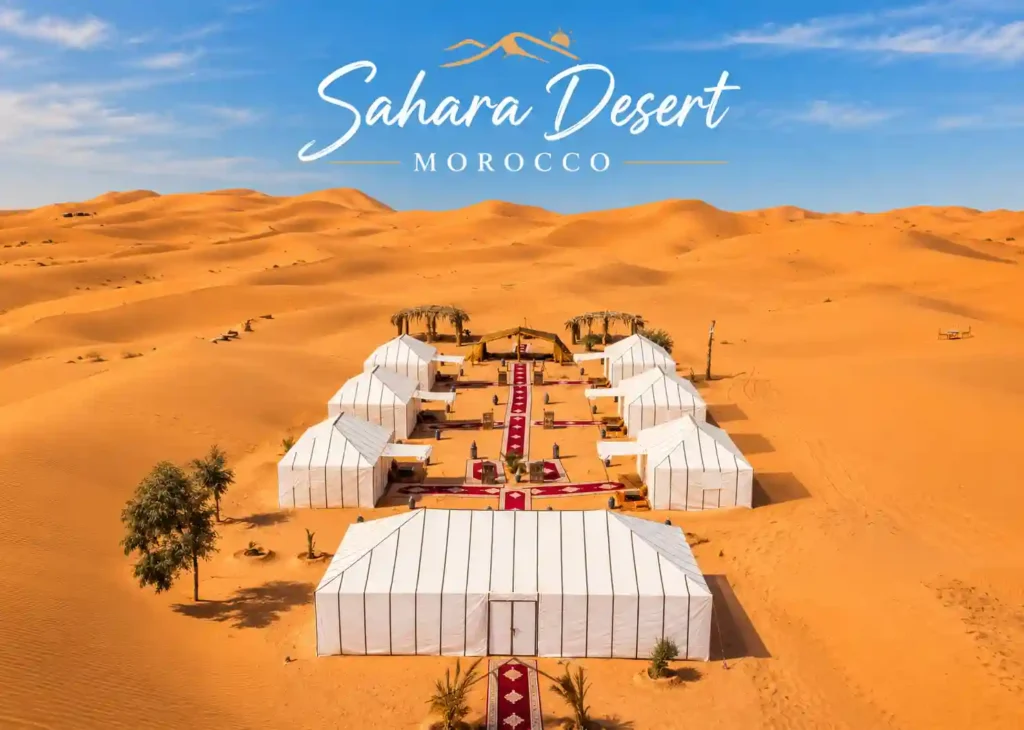
Ask ten people where the Sahara is and you will get ten slightly different answers. “Africa” is the usual one, and it is correct, but it does not tell you much. Is the Sahara in one country or many? Where does it start and where does it stop? Can you actually go there without a military-grade expedition? And what is the best way to see it with your own eyes?
Travellers heading for Merzouga, a small village at the foot of the Erg Chebbi dunes in southeastern Morocco, ask these questions all the time. This guide answers them properly. You will find the exact location of the Sahara, the countries it crosses, how big it really is, what it is made of (hint: far less sand than you think), and how to visit the Moroccan part of it.
Grab a cup of mint tea. This is a long one.
Quick Answer: Where Is the Sahara Desert?
The Sahara Desert is in North Africa. It stretches from the Atlantic Ocean in the west to the Red Sea in the east, and from the Atlas Mountains and the Mediterranean coast in the north down to the Sahel, the semi-arid belt that separates it from tropical Africa, in the south.
It covers around 9.2 million square kilometres, which makes it the largest hot desert on Earth. Only the polar deserts of Antarctica and the Arctic are bigger.
Sahara Desert Key Facts at a Glance
| Fact | Detail |
|---|---|
| Continent | Africa (North Africa) |
| Area | About 9.2 million km² (3.6 million sq mi) |
| Rank | Largest hot desert in the world, third-largest desert overall |
| Share of Africa | Roughly 30% of the continent |
| Western edge | Atlantic Ocean |
| Eastern edge | Red Sea and the Nile Valley |
| Northern edge | Atlas Mountains and the Mediterranean |
| Southern edge | The Sahel |
| Countries | 10 to 11, depending on how you count Western Sahara |
| Typical rainfall | Under 100 mm a year across most of it |
| Famous dune sea in Morocco | Erg Chebbi, next to Merzouga |
Where Exactly Is the Sahara Located on the Map?
Picture the top third of Africa. Now colour almost all of it beige. That is the Sahara. It sits roughly between latitudes 15° and 35° north, right in the band of the world where dry air sinks and clouds struggle to form. The same belt of high pressure creates the Arabian Desert, the Sonoran Desert in North America and the Australian outback.
The Four Edges of the Sahara
West: the Atlantic Ocean. In Mauritania, Western Sahara and southern Morocco, the dunes run almost to the water. There are stretches of coast where you can watch sand and surf meet.
North: the Atlas Mountains and the Mediterranean. In Morocco and Algeria the Atlas range acts like a wall. It catches moisture from the north, which is why Marrakech has snowy peaks on its horizon while the land just south of the mountains is dry. In Libya and Egypt, the desert reaches the Mediterranean coast itself.
East: the Red Sea and the Nile. The Nile is the only major river that cuts all the way through the Sahara. Egypt’s Eastern Desert and Western Desert are both considered part of it.
South: the Sahel. The word comes from the Arabic for “shore”, as in the shore of the desert. It is a transition zone of scrub and grassland running across Mali, Niger, Chad and Sudan. This southern edge moves slightly with rainfall and climate, and in dry decades the desert creeps south.
Is the Sahara in Africa or the Middle East?
Africa, without any doubt. The Arabian Desert is the one in the Middle East, and it is a separate desert, although the two are connected by the Sinai Peninsula and share the same climate belt.
Which Countries Does the Sahara Cover?
The Sahara is not “in” one country. It spreads across 10 or 11, depending on whether you list Western Sahara separately. In some of them it covers nearly everything. In others it is just a slice.
| Country | How much of it is Sahara? | Good to know |
|---|---|---|
| Algeria | Most of the country, roughly four-fifths | Largest country in Africa; home to the Ahaggar Mountains |
| Libya | Almost all of it | Contains the harsh Libyan Desert |
| Egypt | The great majority | The Nile Valley is the exception |
| Mauritania | Most of it | Dunes reach the Atlantic coast |
| Mali | The northern half or more | Timbuktu sits at the southern edge |
| Niger | The northern two-thirds | The Ténéré and Aïr Mountains |
| Chad | The northern part | Tibesti Mountains and the Sahara’s highest peak |
| Sudan | The northern part | Mostly the Nubian Desert |
| Western Sahara | All of it, practically | Atlantic coast desert |
| Morocco | The south and southeast | Erg Chebbi, Erg Chigaga, Draa Valley |
| Tunisia | The southern third | Chott el Djerid salt flats and famous film locations |
Morocco’s share is small compared with Algeria or Libya, but it is probably the most visited part of the whole desert. The reason is simple. You can fly to Marrakech in the morning, and by the next evening you can be sitting on top of a golden dune watching the sun go down. In most other Saharan countries, getting to the desert takes serious planning, and in some of them it is not advisable at all right now.
How Big Is the Sahara Desert, Really?
Numbers like 9.2 million square kilometres are hard to feel, so here is some context.
| Compared with | Approximate size | The Sahara is… |
|---|---|---|
| United States | About 9.8 million km² | Nearly the same size |
| China | About 9.6 million km² | Nearly the same size |
| Europe | About 10 million km² | Slightly smaller |
| Morocco | About 710,000 km² | More than 12 times bigger |
| France | About 550,000 km² | Roughly 17 times bigger |
| Australia | About 7.7 million km² | Larger |
From west to east the desert is around 4,800 kilometres across. That is about the distance from Lisbon to Moscow. From north to south it ranges between 1,200 and 1,800 kilometres depending on where you measure.
Another way to say it: if you drove across the Sahara without stopping, at a steady 80 km/h on roads that mostly do not exist, you would still be driving for around two and a half days.
The Main Regions of the Sahara
Because the desert is so enormous, geographers split it into smaller regions. Each has its own character.
The Western Sahara and the Atlantic Coast
This is the part that meets the ocean. Fog rolls in from the cold Canary Current and, strangely, gives parts of the coast a bit of moisture. Fishing villages sit beside dunes.
The Ahaggar Mountains (Algeria)
Deep in central Algeria, volcanic peaks rise above 2,900 metres. The Tuareg people have lived here for centuries. The landscape looks more like the moon than like the postcard Sahara.
The Tibesti Mountains (Chad)
These are the highest mountains in the Sahara. The peak of Emi Koussi, a volcano, reaches about 3,400 metres. It is remote enough that very few travellers ever see it.
The Libyan Desert
Spanning eastern Libya, western Egypt and a corner of Sudan, this is one of the driest and most empty regions on the planet. Some weather stations there go years without a drop of rain.
The Ténéré (Niger)
“Ténéré” means “desert” in the Tuareg language, which tells you what the locals thought of it. It is a flat sea of sand and gravel with almost no landmarks.
The Moroccan Sahara
This is the part of the desert most travellers visit. It includes the Draa Valley, the long palm-filled oasis that runs down towards M’Hamid, and the two big dune seas, Erg Chebbi near Merzouga and Erg Chigaga near M’Hamid El Ghizlane. More on them in a moment.
What Is the Sahara Actually Made Of?
Here is the thing that surprises almost everyone. Only about one-fifth of the Sahara is sand. The rest is rock, gravel, salt flats, dry riverbeds and mountains.
| Landscape type | Local name | What it looks like |
|---|---|---|
| Sand dunes | Erg | Rolling seas of sand, the classic postcard image |
| Stony plain | Reg | Flat ground covered in pebbles and gravel |
| Rocky plateau | Hamada | Bare, flat bedrock swept clean by wind |
| Dry river valley | Wadi (oued) | Usually dry, can flood suddenly after rain |
| Oasis | Wahat | Palm groves around a water source |
| Salt flat | Chott or sebkha | White crusted basin, sometimes a seasonal lake |
The word “erg” comes from the Arabic for “dune field”. Ergs are the dramatic part, but they make up a relatively small share of the total area. In Morocco, most of the desert is hamada, hard and rocky, which is why the sudden appearance of Erg Chebbi, glowing orange against a dark plain, feels so striking.
How Tall Do the Dunes Get?
In the biggest ergs of Algeria and Libya, dunes can approach 180 metres. At Erg Chebbi the highest dunes rise up to roughly 150 metres above the surrounding plain. That is about the height of a 50-storey building, and climbing one in soft sand, at sunrise, with a mouthful of sand somewhere in your teeth, is a good workout.
Sahara Desert Climate: Hot Days, Cold Nights
People think the Sahara is just “hot”. It is more interesting than that. It is a place of extremes.
- Daytime summer heat can reach 45°C to 47°C in many areas and higher in some.
- Winter nights in the open desert can fall close to freezing, and in places below it.
- Rain is rare and unpredictable. Many places average less than 100 mm a year. Some get none for years, then a whole year’s worth in a single afternoon.
- Sunshine is extreme. Across most of the Sahara there are over 3,600 hours of bright sun per year, and in the east it passes 4,000.
The temperature swing between day and night is the part that catches travellers off guard. Dry air and clear skies mean the ground loses its heat quickly after sunset. A day that felt like an oven can turn into a night where you want a jacket and a blanket.
Climate in Merzouga Through the Year
| Season | Daytime | Night | What it feels like |
|---|---|---|---|
| Spring (Mar to May) | 24°C to 35°C | 10°C to 20°C | Warm and pleasant, occasional wind |
| Summer (Jun to Aug) | 38°C to 45°C | 22°C to 28°C | Very hot; best for sunrise and sunset only |
| Autumn (Sep to Nov) | 25°C to 36°C | 12°C to 20°C | Golden season, comfortable |
| Winter (Dec to Feb) | 15°C to 22°C | 2°C to 8°C | Clear sunny days, very cold nights |
These are rough ranges, not forecasts, and every year is a little different.
Plants and Animals of the Sahara
Life in the Sahara is thin but not absent. Scientists count hundreds of plant species and a few hundred animal species in the desert as a whole.
Animals you might actually see near Merzouga:
- Dromedary camels, the working animal of the desert
- Fennec foxes, tiny with enormous ears, mostly active at night
- Jerboas, small hopping rodents
- Desert lizards, including the spiny-tailed lizard
- Birds such as the desert sparrow, larks, wheatears and, near water, even flamingos
If heavy rain falls, a seasonal lake called Dayet Srji, northwest of Merzouga, can fill up and attract migrating birds. It is one of the most surprising sights in the Moroccan Sahara.
Plants that survive here: tamarisk trees at the edge of the dunes, acacias in the dry valleys, date palms wherever there is groundwater, and small tough shrubs that spend most of the year looking dead.
The Sahara Used to Be Green
This is one of the most surprising facts about the desert, and a favourite on the long drive to the dunes.
Around 11,000 years ago the Sahara was not a desert. It had lakes, grasslands, rivers and herds of animals. People hunted, fished and herded cattle there. Rock paintings in places like Algeria’s Tassili n’Ajjer show giraffes, hippos and swimmers in a land that is now bone dry.
Scientists link this to a slow wobble in Earth’s axis. Over a cycle of roughly 20,000 years, the African monsoon shifts north or south, and the Sahara swings between desert and grassland. Somewhere around 5,000 to 6,000 years ago the rains weakened, and the land dried out over a few centuries. The desert we know today is the current phase of a long cycle, not a permanent fixture.
Beneath the sand there is still ancient water. Huge underground aquifers hold water that fell as rain thousands of years ago, and people tap them through wells and oases.
People of the Sahara: Berbers, Tuareg and Sahrawi
Around two and a half million people live in the Sahara. Most of them live in oases or at the desert’s edges, not out among the dunes.
In Morocco, the main community around Merzouga is Amazigh (Berber). Many families still keep camels, grow dates and run guesthouses. Some are descendants of nomads who moved across the desert with their herds. Further south and east you meet the Tuareg, famous for their blue indigo veils, and the Sahrawi people along the Atlantic side.
Caravans and Sijilmasa
For over a thousand years, the Sahara was a trade highway rather than a barrier. Camel caravans carried gold, salt, ivory and slaves between West Africa and the Mediterranean. Near Rissani, not far from Merzouga, stood Sijilmasa, a wealthy medieval city that controlled one of the key routes from about the 8th century. Its ruins are still there, and it is well worth a stop if you are driving through.
The Moroccan Sahara: Erg Chebbi and Erg Chigaga
Morocco has two major dune seas. They are very different in feel.
| Erg Chebbi | Erg Chigaga | |
|---|---|---|
| Nearest village | Merzouga | M’Hamid El Ghizlane |
| Size | About 28 km long, 5 to 7 km wide | Much larger and more remote |
| Highest dunes | Up to about 150 m | Similar height, wider spread |
| Getting there | Paved road to the village | Several hours on tracks by 4×4 |
| Atmosphere | Dramatic golden dunes, easy access | Wild, quiet, far from everything |
| Best for | First-time visitors, 2 or 3 day trips | Travellers with more time who want solitude |
| Tourism level | Well developed | Limited |
Erg Chebbi lies right along the Algerian border, on the far western edge of the Sahara. Its dunes rise sharply from a flat stony plain, which makes the contrast very photogenic. It is no accident that films like The Mummy (1999) and Sahara (2005) shot scenes here.
Merzouga: The Gateway to the Sahara in Morocco
Merzouga is a small village of a couple of thousand people on the western side of Erg Chebbi. Auberges, hotels and desert camps stretch along the dunes to the north and south. It is where most Sahara trips in Morocco begin and end.
How to Get to Merzouga
| From | Approximate distance | Approximate driving time |
|---|---|---|
| Erfoud | 50 km | 1 hour |
| Rissani | 25 to 40 km | 45 minutes |
| Ouarzazate | 360 km | 5 to 6 hours |
| Fes | 460 km | 7 to 8 hours |
| Marrakech | 560 km | 9 to 10 hours with stops |
Most travellers do the journey as part of a 2-day or 3-day Merzouga desert tour from Marrakech or Fes, although tours also leave from many other Moroccan cities, such as Casablanca, Rabat, Tangier, Agadir and Ouarzazate. The road itself is half the fun. From Marrakech you climb over the High Atlas via the Tizi n’Tichka pass, stop at the fortified village of Ait Benhaddou, pass through Ouarzazate, and follow the Dades Valley and Todra Gorge before reaching the dunes.
There is also a small airport near Errachidia, but most people drive, and the scenery is why.
Best Time to Visit the Sahara in Morocco
| Month | Verdict | Notes |
|---|---|---|
| January | Good | Sunny days, cold nights, bring layers |
| February | Very good | Clear skies, fewer crowds |
| March | Excellent | Mild, green valleys behind you |
| April | Excellent | Warm, ideal for camping |
| May | Good | Getting hot by midday |
| June to August | Challenging | Extreme heat; sunrise and sunset only |
| September | Good | Cooling off, still warm |
| October | Excellent | One of the best months of the year |
| November | Excellent | Comfortable days, cool nights |
| December | Good | Cold at night, very clear sky |
The general rule is October to April. That is when you can ride a camel at midday without regretting it. Summer is possible, and plenty of people do it, but plan activities for early morning and evening.
What to Do in Merzouga
- Camel trek at sunset. The classic experience. You ride into the dunes in the late afternoon and reach camp as the light turns orange.
- Overnight in a desert camp. Traditional tents, a dinner of tagine, music around a fire, and a sky full of stars without a single streetlight.
- Sunrise on the dunes. Climb a high dune before dawn and watch the colours change. Bring a scarf.
- Sandboarding. Slide down the dunes on a board. Easier than it looks, more tiring than it looks.
- 4×4 tour. A good option if you want to cover more ground: nomad families, the abandoned mining area at Taouz, and Dayet Srji if there is water.
- Quad biking. Fun, but keep to the allowed tracks to protect the dunes.
- Visit Khamlia. A village of Gnawa musicians, descendants of people brought across the desert from West Africa long ago.
- Fossil sites near Erfoud. The area is famous for marble with fossils in it. You can see workshops where it is cut and polished.
- Hot sand baths. During summer, some locals bury themselves in the sand for a few minutes, believing it helps with rheumatism.
What to Pack for a Sahara Trip
- Light, loose cotton clothes for the day
- A warm layer or fleece for the night, plus a jacket from November to March
- A scarf or shesh to cover your face from wind and sun
- Sunglasses and sunscreen
- Closed shoes you do not mind getting sandy
- A refillable water bottle
- A small backpack, as your big bag usually stays at the guesthouse
- A power bank, since camps may have limited charging
- Wet wipes and a small towel
- A torch or headlamp
A Simple 3 Day Desert Tour from Marrakech
| Day | Route | Highlights |
|---|---|---|
| Day 1 | Marrakech to Dades Valley | Tizi n’Tichka pass, Ait Benhaddou, Ouarzazate, Dades Gorge |
| Day 2 | Dades to Merzouga | Todra Gorge, Tinghir palm groves, camel trek and night in camp |
| Day 3 | Merzouga to Marrakech or Fes | Sunrise on the dunes, long drive back |
If you have an extra day, add the Draa Valley or a visit to Fes on the way out. Four days makes the whole thing far less rushed.
Desert Camps in Merzouga: Which Type Should You Choose?
Not all desert camps are the same, and the right one depends on your budget, your comfort level and how much of an adventure you want. Here is how the main types compare.
| Standard camp | Comfort or private-tent camp | Luxury camp | |
|---|---|---|---|
| Tents | Simple Berber tents, shared or twin | Larger tents with proper beds | Spacious suite-style tents |
| Bathroom | Shared facilities | Often private or semi-private | Private with hot shower |
| Food | Traditional tagine dinner and breakfast | Same, with more choice | Multi-course meals |
| Atmosphere | Social, lively, drums around the fire | Quieter, more privacy | Calm and polished |
| Best for | Backpackers, groups, first-timers | Couples, families | Honeymoons, special occasions |
| Prices | Lowest | Mid-range | Highest |
A few things worth checking before you book:
- Where the camp is. Some camps sit right at the edge of the dunes, a short walk from the village. Others are deeper in the erg, a proper camel ride away. Deeper means quieter and darker skies.
- Group size. A camp with 80 guests feels very different from one with 12.
- What is included. Dinner, breakfast, camel ride, transfers, sandboarding and a morning shower are not always in the price.
- Recent reviews. Look for comments about cleanliness, blankets in winter and how the staff treat guests.
What a Camel Trek in the Sahara Is Actually Like
The camel trek is the moment most people picture when they book a Sahara trip, so it is worth knowing what to expect.
Camels are guided in a line by a local handler. You mount while the camel is kneeling, and the strange part comes when it stands up: first the back legs, so you lurch forward, then the front legs, so you lurch back. Hold the saddle handle and enjoy it. After that, the walk is slow, swaying and surprisingly relaxing.
Practical tips for the ride
- Wear trousers rather than shorts, since the saddle blankets can rub bare legs.
- Tie a scarf over your head and face in case the wind picks up.
- Keep your camera strapped to you, and your phone in a zipped pocket.
- Sit up straight and let your body move with the camel, not against it.
- Tell your guide if you feel uncomfortable. They are used to it and will adjust the pace.
- Tip your handler if you enjoyed the experience; they work long hours.
A good camel trek is not about speed. It is about the light. Aim for the late-afternoon ride so that the dunes turn orange and pink around you.
Stargazing in the Sahara: The Night Sky Over Merzouga
If the dunes are the day shift, the stars are the night shift. With almost no light pollution and a dry, clear atmosphere, Merzouga is one of the best places in Morocco to see the night sky.
On a moonless night you can often see the Milky Way stretching across the sky, planets shining steadily, and shooting stars every few minutes in peak seasons. Many camps have a fire pit and rugs where you can lie back and look up.
For the best stargazing:
- Choose a night around the new moon, since a full moon washes out the faint stars
- Stay in a camp deeper in the dunes, away from the village lights
- Give your eyes 15 to 20 minutes to adjust to the dark and avoid looking at your phone
- Bring a warm layer, as it gets cold fast after midnight
- Try a stargazing app to identify planets and constellations
What You Eat in the Sahara: Moroccan Desert Food
Food is part of the experience, and desert cooking is hearty, simple and delicious.
| Dish | What it is |
|---|---|
| Tagine | Slow-cooked stew in a clay pot, usually chicken, beef, lamb or vegetables |
| Couscous | Steamed semolina with vegetables and meat, traditionally served on Fridays |
| Berber pizza (madfouna) | A pastry baked under hot sand, filled with spiced meat and onions |
| Harira | A tomato, lentil and chickpea soup, especially common in the evening |
| Moroccan salad | Finely chopped tomatoes, cucumber and onion |
| Dates | Locally grown and eaten fresh, often with tea |
| Mint tea | The national drink, poured from a height and always sweet |
Madfouna is the one to look out for. It is baked in the sand using a fire lit on top, and few visitors ever try it. Ask your guide whether your camp or guesthouse can prepare it.
Vegetarians are usually well catered for in Morocco, with vegetable tagines and couscous available almost everywhere. Let the camp know about any allergies or dietary needs when you book.
Photography Tips for the Sahara
The dunes are one of the most photogenic landscapes on Earth, and also one of the trickiest to shoot.
- Shoot at golden hour. The hour after sunrise and the hour before sunset give long shadows and warm colours. At midday the dunes look flat.
- Look for ridgelines. The sharp edge between light and shadow on a dune is the classic Sahara image.
- Add a person or a camel for scale. Without something to compare, the dunes lose their size.
- Protect your gear. Fine sand gets everywhere. Keep your camera in a sealed bag and change lenses as little as possible.
- Watch your exposure. Bright sand can fool your camera into underexposing. Lift the exposure slightly if photos look grey.
- Try the stars. A tripod, a wide lens and a long exposure will capture the Milky Way on a dark night.
- Leave your footprints out of the frame. Walk along the sides of the dune and let your footprints stay behind you.
Merzouga vs Zagora vs M’Hamid: Which Sahara Gateway in Morocco?
There is more than one way into the Moroccan Sahara. Here is how the three main gateways compare.
| Merzouga | Zagora | M’Hamid El Ghizlane | |
|---|---|---|---|
| Dunes | Erg Chebbi, tall and golden | Small dunes, some distance from town | Erg Chigaga, vast and remote |
| Distance from Marrakech | About 9 to 10 hours | About 5 to 6 hours | About 7 to 8 hours |
| Feel | Dramatic, well developed | Accessible, more oasis than dunes | Wild, quiet, adventurous |
| Best for | Classic dune experience | Short trips with less driving | Travellers wanting solitude |
| Trip length that makes sense | 3 days or more | 2 days | 3 to 4 days |
If your priority is the classic Sahara postcard, with tall golden dunes, Merzouga is the answer. If time is short, Zagora is closer to Marrakech. If you want real remoteness, M’Hamid and Erg Chigaga reward the extra effort.
More Sahara Itineraries From Morocco
4-Day Itinerary: Marrakech to Merzouga and Back, Slowly
| Day | Route | Highlights |
|---|---|---|
| Day 1 | Marrakech to Ait Benhaddou and Dades Valley | High Atlas crossing, kasbah visit, Dades Gorge |
| Day 2 | Dades to Merzouga | Todra Gorge, palm groves of Tinghir, sunset camel trek, night in camp |
| Day 3 | Merzouga | Sunrise, sandboarding or 4×4 tour, Khamlia music, second evening in the dunes |
| Day 4 | Merzouga to Marrakech | Long scenic drive back via Ouarzazate |
5-Day Itinerary: Fes to Marrakech via the Sahara
| Day | Route | Highlights |
|---|---|---|
| Day 1 | Fes to Midelt or Ifrane | Cedar forests, Middle Atlas villages |
| Day 2 | Ifrane to Merzouga | Ziz Valley, Erfoud, sunset camel ride |
| Day 3 | Merzouga to Dades | Sunrise, Todra Gorge |
| Day 4 | Dades to Ait Benhaddou | Roses valley, Ouarzazate |
| Day 5 | Ait Benhaddou to Marrakech | Tizi n’Tichka pass |
The Fes to Marrakech route is a favourite because you do not repeat any road. Most operators can reverse it to run from Marrakech to Fes.
Travelling to the Sahara With Kids, as a Couple or Solo
With children. Families do the Sahara all the time, and kids usually love the camels and sandboarding. Pack extra water and sun protection, and choose a camp close to the village if you have very young children. Long drives can be tiring, so a four-day itinerary is gentler than a two-day one.
As a couple. A private tent, a quiet camp deeper in the dunes and a sunset ride make a memorable trip. Ask for a camp with fewer guests.
Travelling solo. Merzouga is a friendly place for solo travellers, and shared tours are a great way to meet people. Choose a reputable operator and keep a copy of your itinerary.
Etiquette and Culture: Travelling Respectfully in the Moroccan Sahara
A few small habits go a long way.
- Greet people with a simple salam or bonjour before asking a question
- Accept tea when it is offered; refusing can seem rude
- Use your right hand for eating and passing things
- Ask before photographing people
- Dress modestly in villages, with shoulders and knees covered
- During Ramadan, which moves earlier each year, avoid eating or drinking openly in villages during the day. Camps usually still serve tourists, but opening hours and tours may change
Is the Sahara Growing? Desertification and Climate Change
The Sahara is not static. The southern edge, the Sahel, shifts with rainfall. In wetter decades, it greens and pulls back. In dry ones, it creeps south. Researchers have documented an expansion of the desert over the last century, although the exact figures depend on the period and the method used.
Several factors play a part:
- Natural climate cycles, including the long monsoon cycle that has turned the Sahara green and brown over thousands of years
- Overgrazing and tree cutting, which strip the soil and speed erosion
- Changing rainfall patterns, which affect how much grass and scrub survives
Across the Sahel, projects such as tree planting and soil restoration aim to hold the desert back. They show that land use matters as much as the weather.
The Sahara and the Amazon: Dust That Crosses an Ocean
Here is a fact to surprise your friends. Every year, huge clouds of fine dust blow out of the Sahara, cross the Atlantic Ocean and settle over the Caribbean and the Amazon rainforest. Scientists believe this dust carries minerals, including phosphorus, that help fertilise the rainforest soil.
The same dust sometimes reaches Europe too. If you have ever woken up to find an orange film on your car in southern Spain or France, the Sahara probably sent it. It is a reminder that the desert is connected to the rest of the world.
Common Myths About the Sahara
“The Sahara is all sand.” No. Only roughly a fifth of it is sand dunes. Most of it is rock and gravel.
“It is hot all the time.” Days are hot, yes. Nights can be bitterly cold, and winter days are mild.
“Nothing lives there.” Plenty does, from foxes to birds to millions of people.
“It is empty and dangerous everywhere.” Parts of the Sahara are difficult or unsafe for travel because of conflict or remoteness. The Moroccan Sahara around Merzouga, though, is a well-established tourist destination with developed infrastructure, local guides and guesthouses.
“The Sahara has always been a desert.” It has been green several times in the last few hundred thousand years.
Responsible Travel in the Desert
The dunes look indestructible, but the surrounding ecosystem is fragile. A few simple habits make a difference.
- Take your rubbish with you, including cigarette butts and water bottles
- Stay on marked tracks when using quads or 4x4s
- Choose a camp or tour operator that employs local people and treats its camels well
- Ask before photographing people, especially women and children
- Dress modestly in villages, which locals appreciate
- Use water carefully; it is precious here
Frequently Asked Questions About the Sahara Desert
What continent is the Sahara Desert in?
Africa. It covers much of the northern part of the continent.
How many countries are in the Sahara Desert?
Between 10 and 11, depending on whether Western Sahara is counted separately. They are Algeria, Chad, Egypt, Libya, Mali, Mauritania, Morocco, Niger, Sudan, Tunisia and Western Sahara.
Is the Sahara the biggest desert in the world?
It is the biggest hot desert. Antarctica and the Arctic are larger, but they are cold deserts.
Is there a Sahara Desert in Morocco?
Yes. The south and southeast of Morocco are part of the Sahara. The best-known areas are Merzouga with Erg Chebbi, and M’Hamid with Erg Chigaga.
How far is Merzouga from Marrakech?
Around 560 kilometres by road. Most people take two or three days, breaking the trip at Ait Benhaddou and the Dades or Todra gorges.
What is the best month to visit the Sahara in Morocco?
October, November, March and April are usually best. January and February are great if you pack warm clothes for the nights.
Can you see the Sahara on a short trip?
Yes. A 2-day trip from Marrakech is possible, but the driving is long. Three days is the sweet spot for most visitors.
How cold does the Sahara get at night?
In winter, temperatures in the Moroccan desert can drop to a few degrees above freezing. Even in spring and autumn, evenings cool down fast, so a jacket is a good idea.
Is it safe to travel to the Sahara in Morocco?
Merzouga and the Erg Chebbi area are among the most popular tourist destinations in Morocco, and thousands of travellers visit every year. As anywhere, use a reputable operator, follow your guide’s advice, drink enough water and check current travel advice from your government before you go.
How long does a camel trek in Merzouga last?
Most sunset camel treks take between one and two hours each way, depending on the camp’s location.
Do I need a visa to visit Morocco and the Sahara?
It depends on your nationality. Many visitors from Europe, North America and several other regions can enter Morocco without a visa for a limited stay. Rules change, so check with your embassy or an official source before you book.
Is it worth spending a night in the desert, or is a day trip enough?
A night is worth it. The best parts of the Sahara are at sunset, at night under the stars and at sunrise, and a day trip misses all three.
What is the difference between Erg Chebbi and Erg Chigaga?
Erg Chebbi is near Merzouga, easier to reach and better developed for tourism. Erg Chigaga is near M’Hamid, larger, more remote and reached by 4×4 on tracks.
Is there Wi-Fi or phone signal in the desert camps?
Signal varies. Many camps near the village have some coverage, while camps deeper in the dunes may have little or none. Treat it as a chance to disconnect.
Can I do a Merzouga tour in summer?
Yes, but it is very hot during the day. Plan your activities for early morning and evening, drink plenty of water and choose a camp with air movement or shade.
What should I wear on a camel trek?
Light, loose trousers, a long-sleeved top for sun protection, closed shoes and a scarf. Bring a warm layer for the evening.
How many days do I need for a Sahara tour from Marrakech?
Three days is a comfortable minimum for Merzouga. Two days is possible but you spend most of it in the vehicle.
Is the Sahara hotter than other deserts?
Among hot deserts it is one of the hottest and driest, though some deserts, such as parts of the Middle East and Death Valley in the United States, can match it in summer.
Does it ever snow in the Sahara?
Yes, rarely. Snow has been recorded on the Algerian side of the Sahara and on the high mountains, and it is an unforgettable sight when it happens.
Final Thoughts: The Sahara Is More Than a Dot on the Map
So, where is the Sahara Desert? In North Africa, across eleven countries, spanning an area as big as the United States, and, in the southeast corner of Morocco, within reach of a single long weekend.
It is a landscape that does not fit into one description. It is red rock, black gravel, white salt, golden sand, ancient rivers, and the quietest night sky you will ever sit under. Reading about it is a start. Standing on a dune at sunrise, with the whole plain below you turning from grey to pink to gold, is another thing entirely.
If you want to see the Moroccan Sahara for yourself, you can book a camel trek, a night in a desert camp or a full multi-day tour. Tours across Morocco leave from many different cities, including Casablanca, Rabat, Tangier, Agadir, Essaouira, Chefchaouen, Ouarzazate and more, so you can start from wherever suits you best. And the Sahara is only one part of the story: Morocco also offers imperial cities, the Atlas Mountains, the blue streets of Chefchaouen and the Atlantic coast. Decide how many days you have and what you like, then build the trip around it.
Planning a trip? Check current availability, group sizes and route options before you book.